Waterfront living in Westport comes with tides, views, and a few extra rules to get right. If you are buying or selling near Channel Islands Harbor, flood maps, insurance requirements, and California’s disclosure laws can feel confusing at first. This guide breaks down how flood zones are defined, when lenders require insurance, what sellers must disclose, and how to verify a property’s status. Let’s dive in.
Westport flood risk at a glance
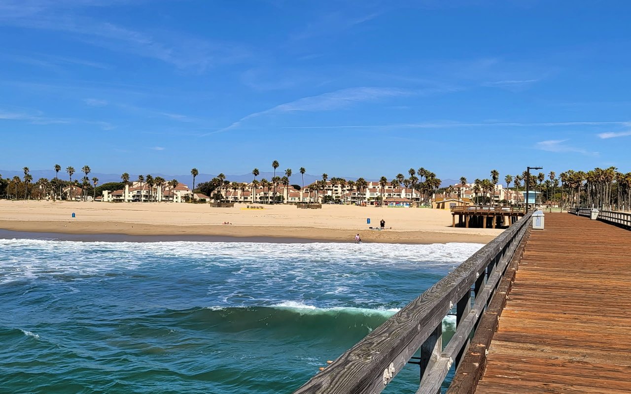
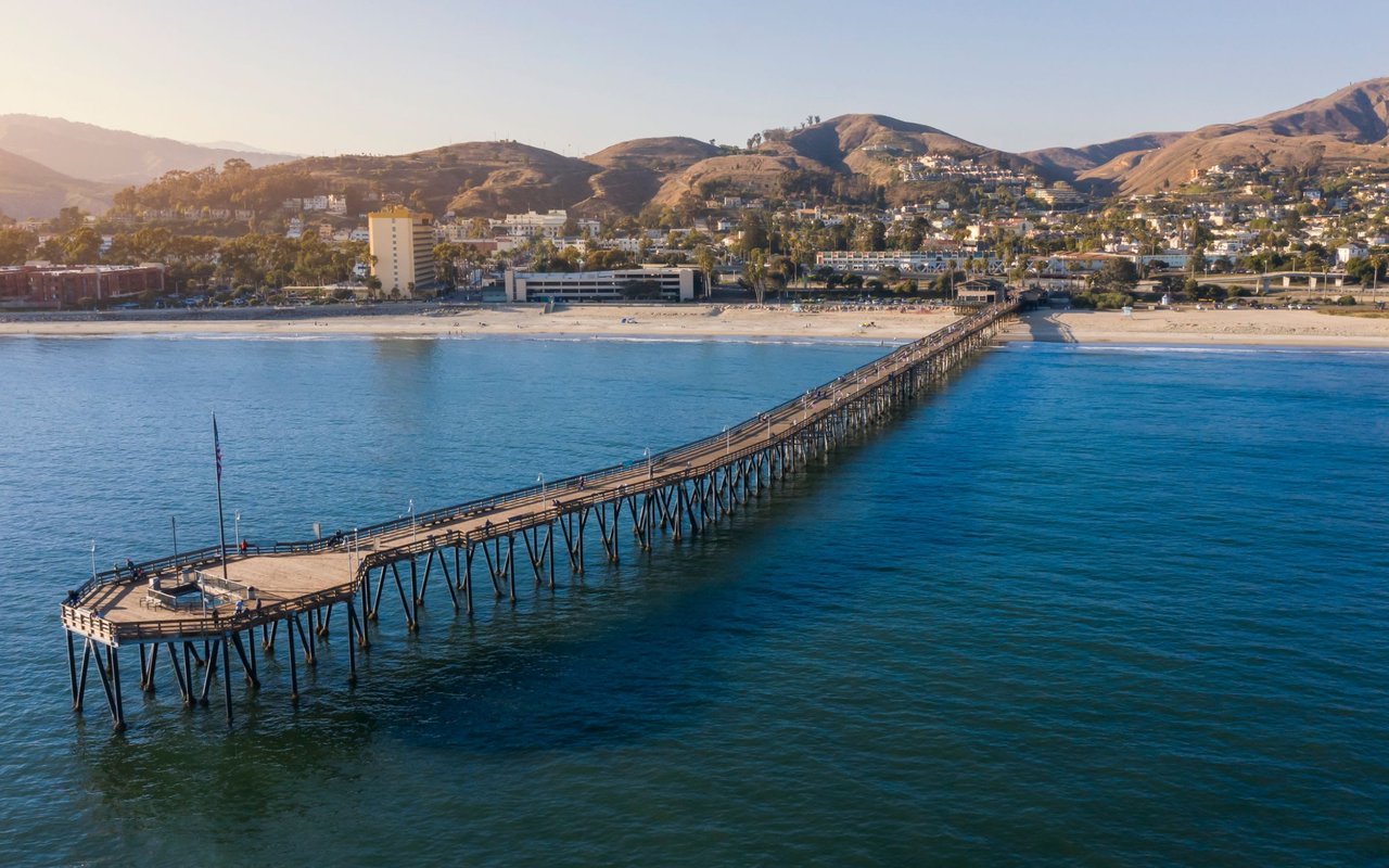
Westport sits along Channel Islands Harbor in the City of Oxnard, a coastal setting where flooding can result from high tides, storm surge, and long-term sea level rise. State planning recognizes that sea level rise will increase the frequency and depth of coastal flooding over time, which can affect insurability and permitting in harbor neighborhoods. You can review statewide sea level rise guidance for planning context through the California Ocean Protection Council’s latest update. For regional adaptation work and maps, check Ventura County’s VC Resilient Coastal Adaptation resources.
FEMA flood zones explained
Special Flood Hazard Areas
FEMA maps “Special Flood Hazard Areas” as locations with a 1 percent annual chance of flooding. These show up as Zone A or AE on most maps. Lenders use these maps to decide whether a federally related mortgage must include flood insurance.
Coastal V and VE zones
Along exposed coastlines, V or VE zones indicate areas with wave action and higher velocity water. These zones carry stricter building and elevation standards and usually higher insurance costs than AE zones.
What about Zone X or Shaded X
Areas mapped outside the SFHA, often labeled X or Shaded X, are lower or moderate risk, but flooding can still occur. Many claims happen outside high-risk zones, so treat risk as a spectrum rather than all or nothing.
Flood insurance basics
When lenders require it
If your Westport home is in a mapped SFHA and your loan is from a federally regulated lender, flood insurance is required. A FEMA Letter of Map Amendment or Revision can remove the federal requirement if it shows the structure or lot is above the Base Flood Elevation, though a lender may still require coverage as a condition of the loan.
NFIP vs private options
You can buy coverage through the National Flood Insurance Program or from private carriers. Private policies vary by company, but they can satisfy a lender’s requirement if the policy is at least as broad as NFIP coverage. Compare coverages, limits, exclusions, and deductibles side by side.
What drives your premium
Pricing depends on your exact location, elevation relative to Base Flood Elevation, construction details, prior claims, and coverage limits. While consumer outlets often cite statewide averages near the low four figures per year, coastal AE and VE properties at low elevation can be higher. An Elevation Certificate can help refine quotes and may reduce NFIP premiums.
California disclosures for sellers
The NHDS requirement
California requires a Natural Hazard Disclosure Statement when a property lies in a mapped hazard zone, including FEMA flood zones A or V. The NHDS is separate from the Transfer Disclosure Statement and must be delivered prior to transfer.
Known issues to share
If you know about prior flooding, water intrusion, or related repairs, those facts should be disclosed on standard transfer forms or otherwise. In marina neighborhoods, also be ready to provide relevant HOA or harbor documents that reference maintenance duties or rules that could affect risk and access.
Step-by-step checklist for Westport
- Check the FEMA map. Use the FEMA Flood Map Service Center to search the address and print a FIRMette. Note the panel, effective date, and whether the lot or structure shows in Zone A, AE, V, or VE.
- Call local floodplain staff. For Westport addresses inside Oxnard, contact the City’s Floodplain Administration for parcel details, local amendments, or past determinations. They can also point you to forms and next steps.
- Get an Elevation Certificate. A licensed surveyor or engineer can document your building’s elevation relative to BFE. This is useful for quotes and sometimes required by the NFIP. Oxnard provides guidance and the FEMA form.
- Consider a LOMA or LOMR. If you believe a structure is above BFE, review FEMA’s process to amend or revise the map. A successful determination can remove the federal insurance mandate.
- Compare insurance quotes. Request an NFIP quote and at least one private-market quote. Compare building and contents coverage, limits, exclusions, and deductibles. Ask how an Elevation Certificate affects pricing.
- Plan for sea level rise. Review Ventura County’s coastal adaptation work and the state’s sea level rise guidance when evaluating long-term exposure, future permitting, and potential maintenance costs.
- Package disclosures early. Provide the NHDS when applicable, plus any Elevation Certificates, prior LOMA/LOMR letters, and known flood or water-intrusion history. Buyers should request these items early in escrow.
Planning ahead in Westport
For a harbor home, your long-term strategy should include verifying current FEMA mapping, understanding lender expectations, and staying aware of county and state coastal planning. This approach helps you set realistic insurance budgets, avoid closing delays, and protect resale value.
Ready to navigate your options with a local harbor specialist by your side? Reach out to Eric Swartz, LIV Sotheby’s International Realty for clear, practical guidance tailored to Westport and Channel Islands Harbor.
FAQs
What is a Special Flood Hazard Area in Westport?
- It is a FEMA-mapped area with a 1 percent annual chance of flooding, typically labeled Zone A, AE, V, or VE, and it often triggers lender-required flood insurance.
When will a lender require flood insurance on a Westport home?
- If your building is in a FEMA SFHA and you have a federally regulated mortgage, the lender must require flood insurance; cash buyers are not under this federal rule but may still choose coverage.
How do NFIP and private flood insurance differ for harbor homes?
- NFIP policies are standardized and widely accepted, while private policies vary by carrier; compare coverages and exclusions to ensure a private policy meets or exceeds NFIP standards.
Can you challenge a flood zone to lower costs?
- Yes, a FEMA Letter of Map Amendment or Revision can remove or adjust a designation if elevations show the lot or structure is above the Base Flood Elevation.
What does California’s NHDS require about flooding?
- Sellers must disclose if a property is in a mapped FEMA flood zone and share known information about past flooding or damage, separate from the Transfer Disclosure Statement.
How much does flood insurance typically cost in California?
- Costs vary by elevation, zone, structure details, and coverage; statewide averages published by consumer outlets are only rough guides, so get a property-specific quote.
Where do you verify a Westport property’s flood status?
- Start with a FIRMette from FEMA’s map site, then confirm details and local guidance with Oxnard’s Floodplain Administration.
Do tsunami zones change insurance or disclosure rules?
- Tsunami hazards matter for safety and planning, but they do not directly determine NFIP flood insurance requirements; check local emergency resources for evacuation planning.